
Surveying
Discipline Surveying
Industry Leading
We are at the forefront of the profession, embracing the latest technology – 3D laser scanners, robotic total station instrumentation, and dual frequency global positioning systems (GPS). Field work is followed by data processing, and drawing production using high spec computer systems and industry standard software. We offer a complete surveying service.
We are equipped to tackle any job, anywhere in the UK, regardless of size or complexity. Our robotic total stations are equipped with reflector-less technology for remote measurement up to 400m when access is not available. Instruments are motorised with an automatic target recognition function which allows our surveyors to automatically track, measure and record targets. This allows surveys to be more efficient, faster and more accurate.

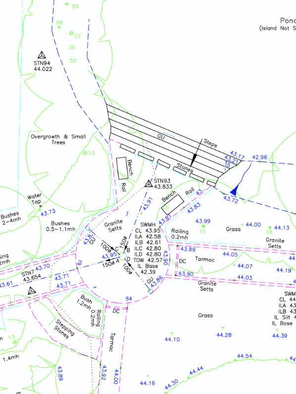
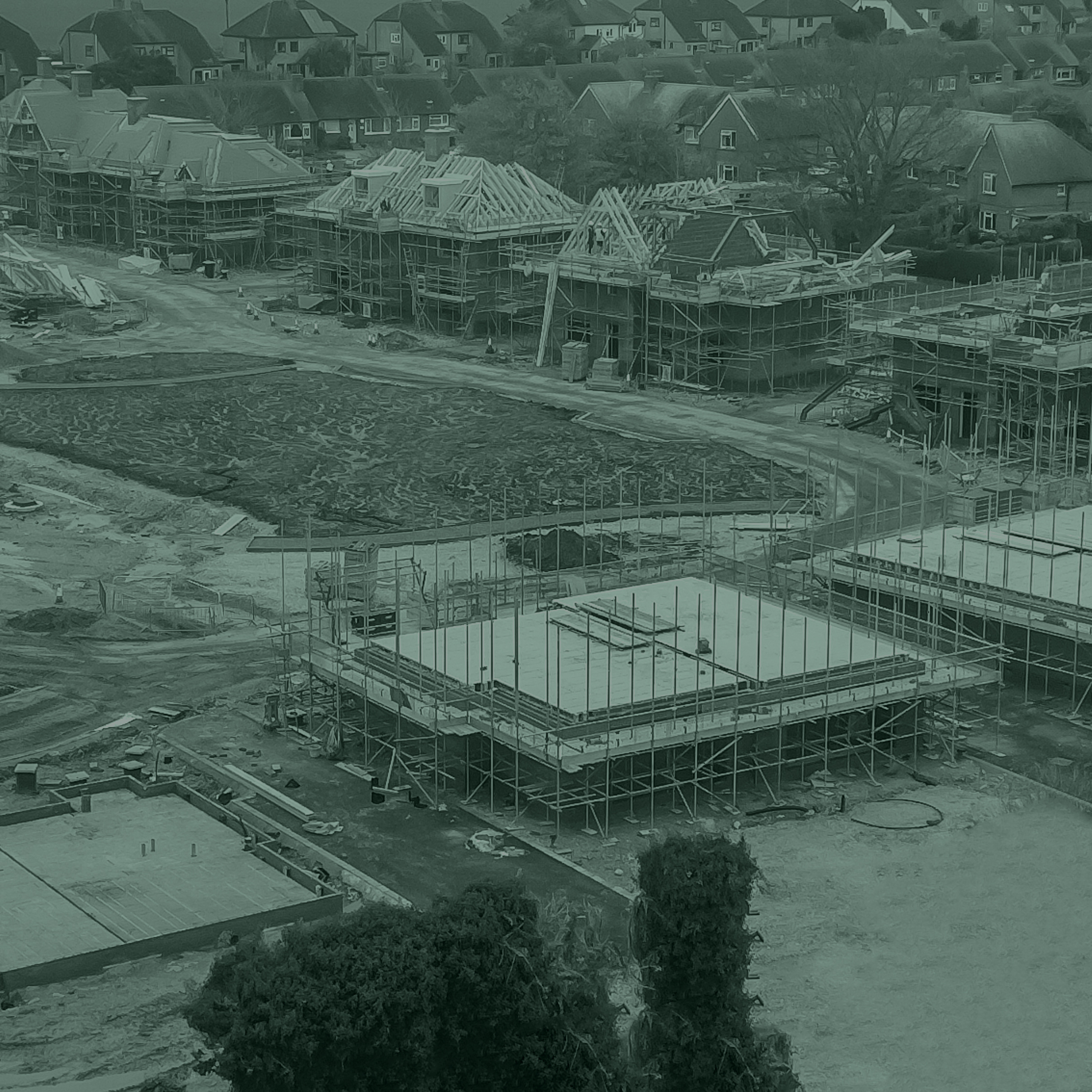
( ↑ ) The Boat House, Oxfordshire
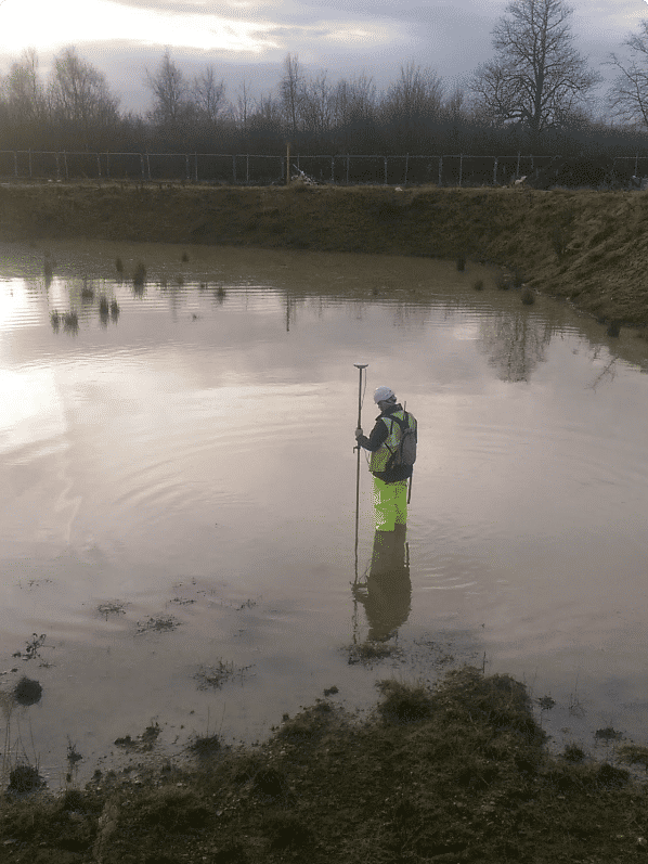
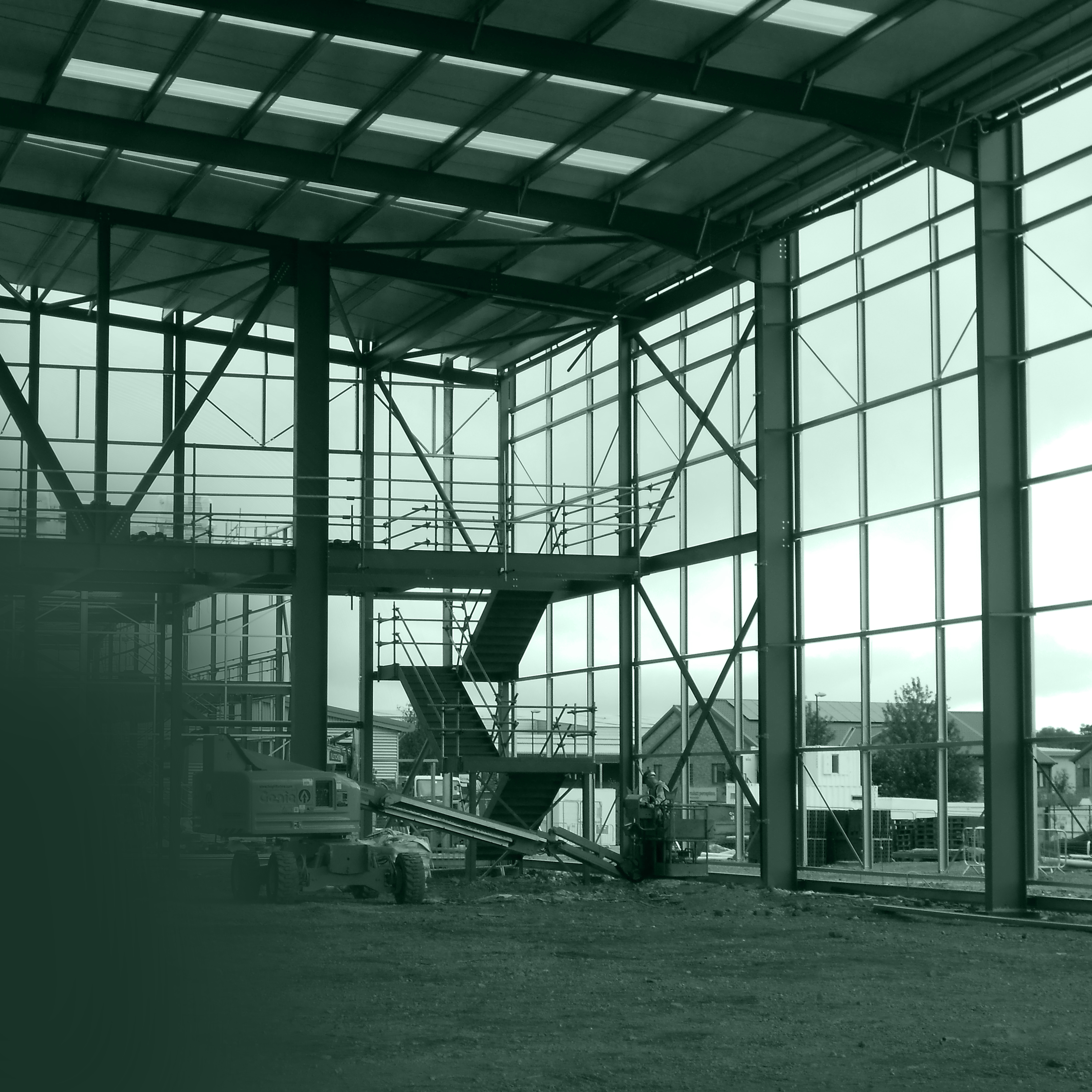
( ↑ ) Project Eastmead
Engineering Surveys
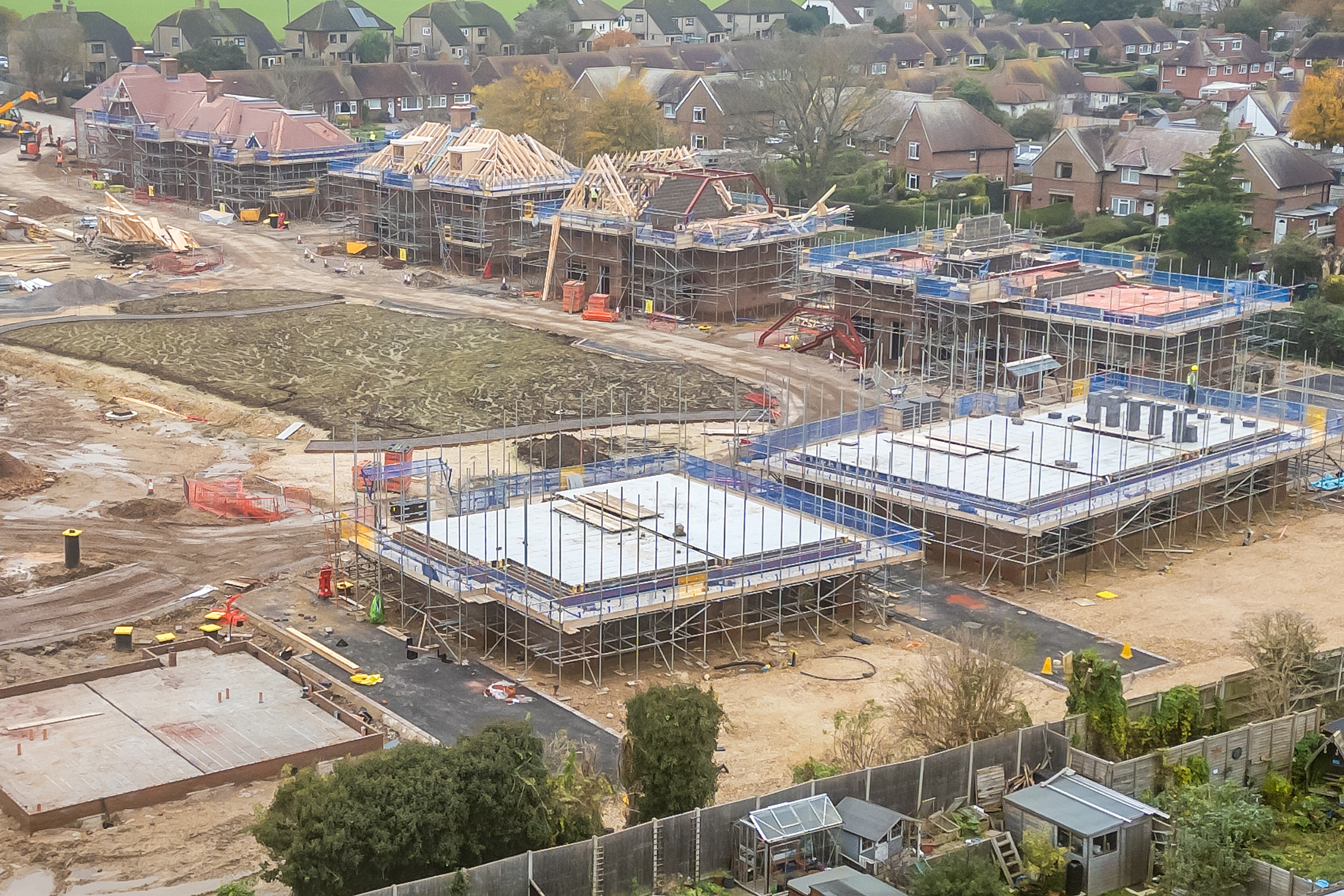
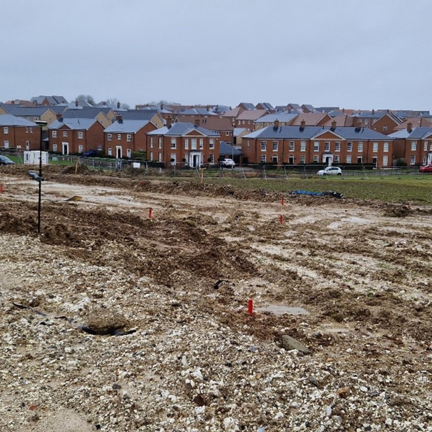
Our surveyors have many years experience working on construction projects from simple house extensions to multi million pound projects. We can conduct as-built surveys, setting out, monitoring, level surveys, installation of site control, post demolition surveys, verticality checks and general measurement and dimensional troubleshooting.
As-built surveys often include drainage details for section 104 following construction to show compliance with design. Section 38 and 278 as-builts surveys also for onsite and offsite works.
Our total station and laser scanning instruments can be used for monitoring movement on site, or adjacent to site where party wall agreements are in place. We can also provide photographic condition reports – usually to safeguard claims against the client for damage to surrounding roads and property by recording before and after construction.
Related Surveying Projects:
View All →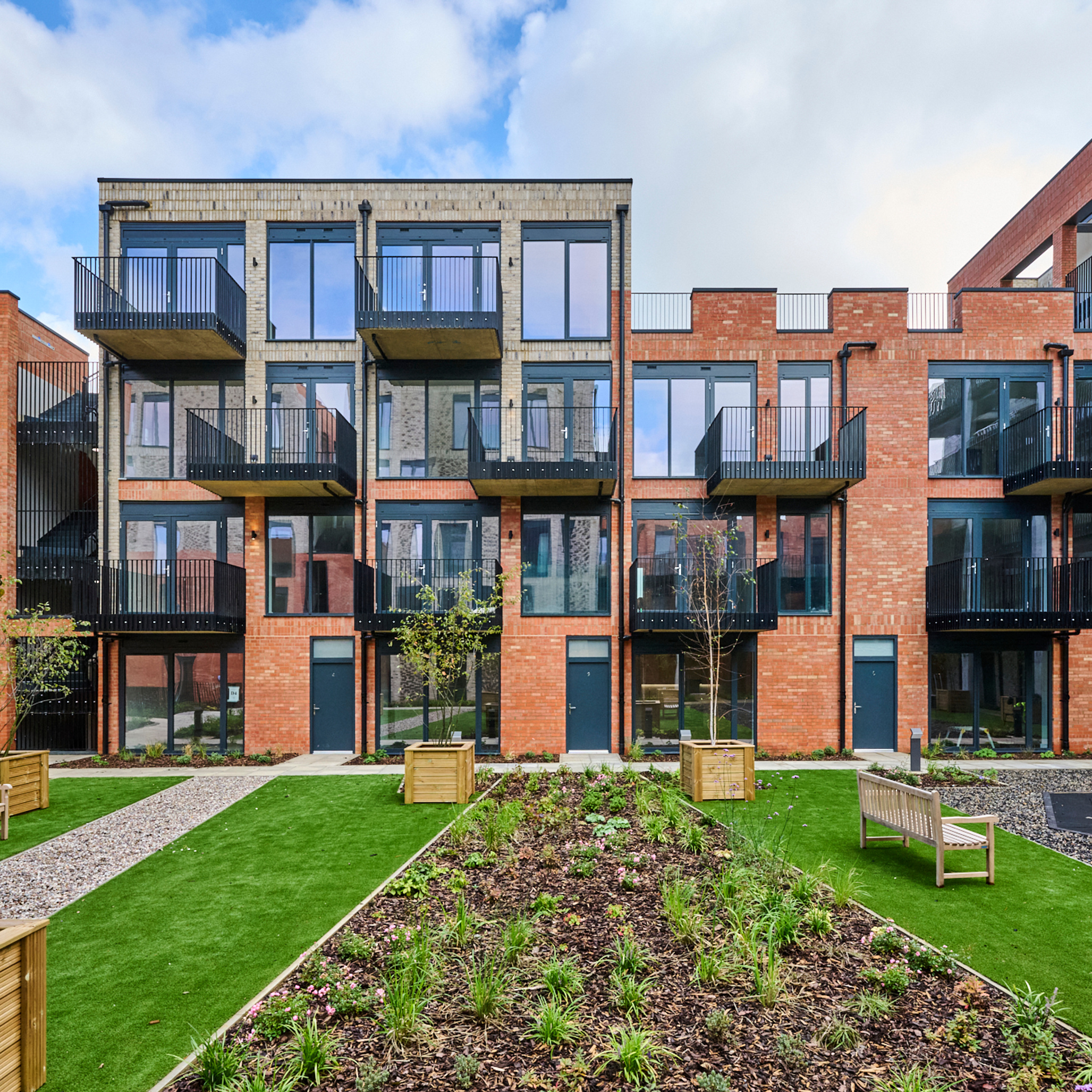
FAQs
It combines traditional land surveying with modern technologies like GPS/GNSS, drones, laser scanning (LiDAR), GIS, and remote sensing to produce accurate maps and spatial information.
Our services can be divided into the following three main categories:
Topographical Surveys
Measured Building Surveys
Engineering Surveys
Measures land boundaries and property lines
Produces topographic and engineering surveys
Uses GNSS/GPS receivers, total stations, drones, and laser scanners (LiDAR)
Supports construction, infrastructure, mining, and land development
Ensures legal accuracy for land ownership and development
Uses GIS and CAD software
These technologies allow surveyors to collect highly accurate spatial data efficiently.
Defining property boundaries and preventing disputes
Planning and constructing infrastructure
Environmental monitoring and resource management
Urban planning and smart cities
Disaster management and risk assessment
Accurate spatial data underpins safe, legal, and sustainable development.
Key aspects of a topographical land survey include:
Level Data: The survey records the levels of various points on the land to show changes in height and slope. Ground levels can be represented by contour lines on a map to indicate ground elevation or depression.
Natural Features: Hills, valleys, watercourses, trees and vegetation.
Man-Made Features: Buildings, roads, fences, walls, utility poles, and drainage covers (manholes, gullies).
Boundaries: Property lines and surrounding features.
Informs Design: Guides decisions on grading, drainage, and placement of new structures.
Supports Planning: Essential for planning applications and gaining approvals.
Reduces Risk: Identifies potential problems like poor drainage or site constraints early.
Foundation for Development: Provides the accurate data needed for architects, engineers, and contractors.
Floor Plans: Detailed layouts showing walls, windows, doors, plant, and floor levels.
Elevations: Accurate drawings of the building’s exterior and interior facades.
Sections: Vertical cuts through the structure to show internal height, floor-to-floor relationships, and structural details
Reflected Ceiling Plans: Mapping of ceiling features, including lighting and HVAC, if required
Accurate Planning: Provides a reliable foundation for architects, engineers, and surveyors, preventing errors in construction.
Refurbishment & Renovation projects: Essential for understanding the existing structure before making design changes or structural improvements.
Space Management: Used to calculate accurate gross or net internal areas for leasing.
Historical Preservation: Recording the precise, detailed and digital record of an existing heritage building for restoration, conservation purposes, or adapting historical structures without losing their architectural integrity.
Key types of engineering surveys include:
Site Setting Out: The precise process of transferring architectural and engineering designs from design drawings onto the physical ground. Generally, markers, pegs, or pins are used to define exact locations, elevations, and boundaries for construction, ensuring structures are built in the correct position, orientation, and level, preventing errors and reducing rework.
As-built Surveys: A detailed, post-construction survey that records the final, exact, physical location, dimensions, and specifications of a constructed project. It highlights deviations from original design plans, confirming compliance and providing accurate data for future maintenance, renovations, or regulatory adoption
Monitoring: The systematic, real-time tracking of construction progress, structural integrity, and safety through technical data, sensors, and site inspections. It ensures projects align with design specifications, budgets, and safety regulations, identifying potential issues—such as structural movement.
Establishing Control Networks: The creation of a precise and stable framework of reference points (such as reflective targets and survey stations) across a construction site.
Verticality Check Surveys: This is a precise measurement process used to determine if vertical structural elements—such as columns, walls, and high-rise structures—are built perfectly plumb and aligned with design specifications. This is to Ensure vertical alignment to prevent structural stresses, safety hazards, and issues with cladding or, in high-rises, lift installations.
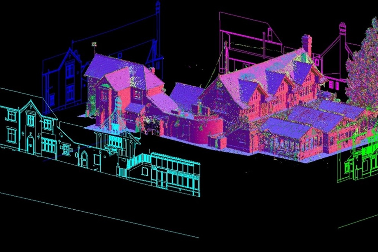
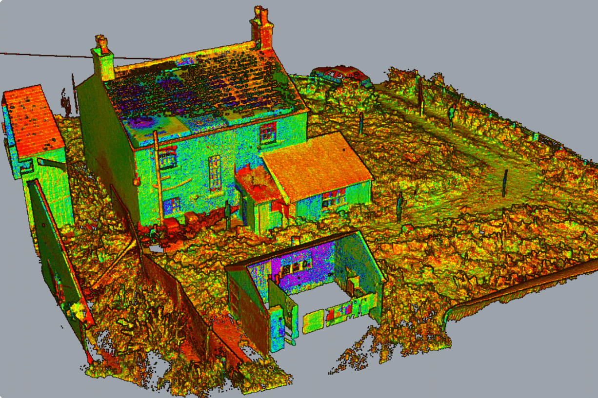
A 3D point cloud is a collection of individual data points in space, each defined by X, Y, and Z coordinates. These points represent the surface geometry of objects or environments – forming a digital twin of the real world. Each point may also carry additional information such as colour & intensity.
Rapid Data Capture and Efficiency – Scanners record millions of data points per second, enabling comprehensive surveys of large sites or complex geometries in a fraction of the time required by manual methods.
Non-Invasive Measurement – Because scanning is optical, there’s no physical contact with the object ideal for when capturing delicate artifacts, sensitive equipment, or hazardous areas.
Reduced HSE Risk – Operators can remain at a safe distance when scanning unstable structures or dangerous zones, cutting down on site visits and complex safety setup.
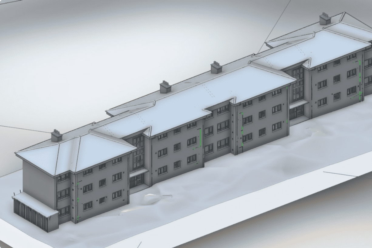
Building Information Modelling (BIM) – Point clouds deliver exact, millimetre-accurate templates for scan-to-BIM workflows.
Precision Measurements and Detailed Analysis – Beyond XYZ coordinates, point clouds often include colour and intensity data.
Digital Twin Creation and Real-Time Monitoring
Enhanced Visualization and Clash Detection
Improved Collaboration and Remote Review
Site Progress Monitoring
Explore Our Disciplines
Civil Engineering
Our Civil Engineering specialists have extensive expertise built up over 40 years with a full range of professional civil engineering services
Structural Engineering
Our Structural Engineering team design sustainable structures that bring architectural visions to life, enhancing communities and supporting a resilient future.
Fire Engineering
Wintech can provide expert specialist fire engineering consultancy and advice at every stage of the project - new build or existing.

Building Services (MEP)
Our Building Design (MEP) Consultants bring a depth of operational experience and coordinated expertise to our client’s projects.
Façade Engineering
Wintech is one of the UK’s leading façade engineering consultants, trusted by architects, developers, and contractors

Façade Access Consultancy
From concept to completion, our façade access consultancy team develop strategies that will provide safe access to all areas of the building envelope
Surveying
We are at the forefront of the profession, embracing the latest technology. We offer a complete surveying service and are equipped to tackle any job in the UK